It’s a simple idea: where land and river boundaries are disputed, make a map. Putting it into practice, using the unwritten knowledge and oral histories of farmers, nomads and of grandmothers who read bird migration patterns to forecast rain, is a little harder.
But Hindou Oumarou Ibrahim says she is a fighter. “If you’re born as an Indigenous person, you’re born an activist, because you’re born with the problems surrounding your community,” she says.
Her native Chad is on the frontline of the climate crisis, with temperature increases predicted to be 1.5 times higher than the global average rises. The UN describes Chad as “one of the world’s most environmentally degraded countries”. In 2020, record rainfall caused a huge loss of food stocks and displaced hundreds of thousands while last year’s floods left more than 160,000 homeless. The changing weather has already wrecked the lives of pastoralists, who cannot milk their dehydrated cattle.
Desertification has shrunk farming and grazing lands and nomads such as the Mbororo – Ibrahim’s people – and farmers are being pushed into conflict while government and military land grabs have further reduced access to water.
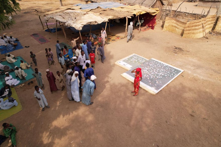
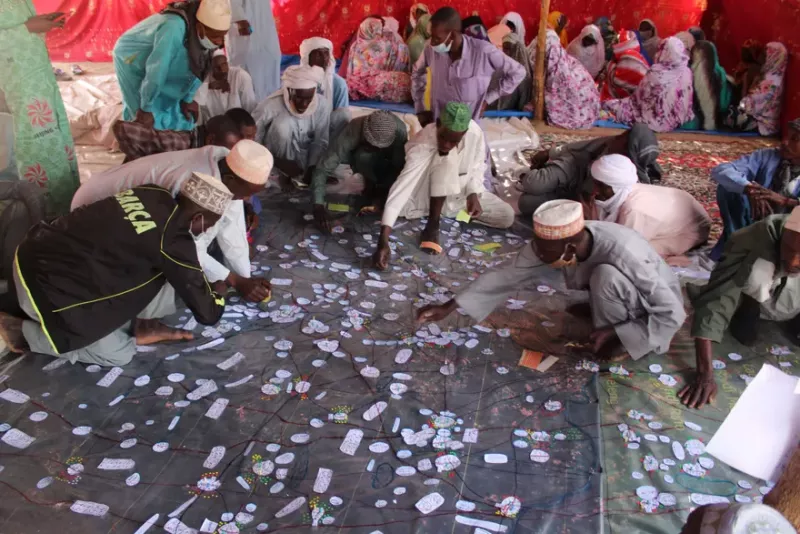
To help mitigate tensions, Ibrahim is working with communities to produce maps to enable them to agree on the sharing of natural resources. Using high-resolution satellite images, Ibrahim and representatives from EOS Data Analytics ran workshops with leaders from 23 villages in Mayo-Kebbi Est to map 1,728 sqkm. People added features such as rivers, settlements and roads, as well as sacred forests, medicinal trees, water points and corridors for cattle. Laminated copies of the maps were distributed to each community. She is conducting a similar exercise on the shores of Lake Chad.
Ibrahim said it was vital to involve women in the process, not just to ensure their representation, but because of the knowledge they have, such as how to find water in the dry season.
“In the west, people check their weather app to find out if it’s going to rain,” Ibrahim says. “Our best app is our grandmothers because they can just observe the cloud positions, the bird migration, the wind directions, or the little insects, and say, ‘Oh, it’s going to rain in two hours!’”
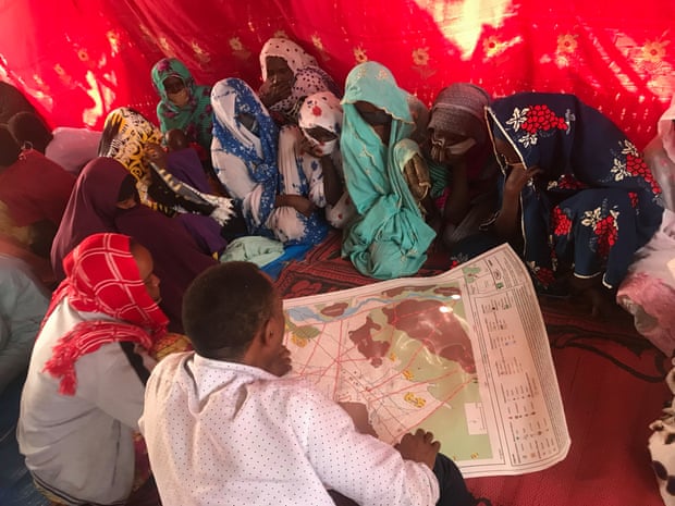
Workshop to map territory in Mayo-Kebbi Est region of Chad
Community members added features to the maps including sacred forests, medicinal trees, water points and corridors for cattle. Photograph: Courtesy of Afpat
Ibrahim, who has chaired Indigenous peoples initiatives at four UN climate conferences and was listed by Time as one of 15 women leading on climate action in 2019, wants to use the map to show how Indigenous-led crisis response can be combined with technology – and work.
As a Mbororo woman she understands what marginalisation means. Her mother, who never went to school, fought to educate her and her sister in Chad’s capital, N’Djamena, where Ibrahim was teased for “smelling like milk” by classmates.
“I grew up between two cultures,” says Ibrahim. Her mother, who learned to read and write two years ago, has now mastered WhatsApp. “She said, ‘You’re travelling a lot, and I need to hear your voice,’ so you see, being an activist in my community is being innovative over the generations.”
At school, Ibrahim started thinking about the changes she wanted to see around her.
“I realised that I can’t talk about women’s rights without talking about community rights. I can’t talk about community rights without talking about the environment we live in and depend on,” she says. At 15, she founded the Association for Indigenous Women and Peoples of Chad (Afpat), focused on women’s rights and environmental protection.
In 2019, Chad ranked bottom on the Notre Dame Global Adaptation Initiative index, which measures vulnerability and resilience to climate change in 182 countries.
Herder Aliou Ndong, left, during the move south, where he has found better grazing for his cattle.
“Sometimes I just cry. Because I say, we are going to end. I will have no peoples, just a history that my peoples used to be nomadic with cattle,” Ibrahim says.
“But when I see the communities who are every day standing up to protect nature, it gives me more hope and energy.” Those who participated in the mapping are using it to agree how to use the environment sustainably. One community has even constructed a building to hold a physical copy.
But international responses drain Ibrahim. “We are in a climate crisis, but companies are still digging for more fossil fuels and governments are not making decisions to shift to clean energy,” she says. “Maybe they call them developed countries, but I call them overdeveloped countries. They get more than what they need to survive in a good way, yet they are not acting fast enough to ensure we can also survive.”
