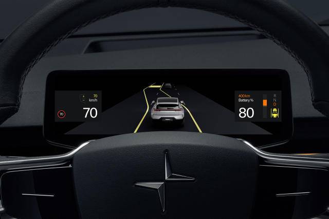
Google is rolling out a brand-new high-definition version of Google Maps for cars with the tech giant’s native Android Automotive operating system. The HD maps will provide granular details that were not previously available, like lane markings, road signs, and traffic barriers. The first vehicles to get the new HD maps will be the Volvo EX90, the Swedish automaker’s new flagship electric vehicle due out later this year, and the Polestar 3, the Volvo-backed performance marque’s first SUV. The Volvo EX90 and Polestar 3 will share the same platform, Volvo’s Scalable Product Architecture (SPA2), and both use Android Automotive, which is Google’s native in-car operating system.
/cdn.vox-cdn.com/uploads/chorus_asset/file/24337888/308303_HD_Maps.jpg)
Both Volvo and Polestar tout the inclusion of Google’s HD maps as a step toward more precise, safer advanced driver-assistance features. That includes so-called “unsupervised” driving features like Volvo’s Pilot Assist, which the automaker claims will enable drivers to take their hands off the steering wheel and eyes off the road for certain stretches of highway driving. The road data provided by Google’s HD maps, combined with inputs from vehicle sensors like cameras, radar, and lidar, are processed by each vehicle’s Nvidia computing system, which in turn, powers the driver-assist functions.
“Building on our long history of mapping the world, Google’s new HD map is designed specifically for automakers and provides comprehensive lane-level and localization data that is crucial to powering the next generation of assisted and autonomous driving systems,” said Jørgen Behrens, VP and general manager of Geo Automotive, Google, in a statement. “We’re excited to continue partnering with leading automakers like Volvo to improve the safety and comfort of drivers everywhere.”


